
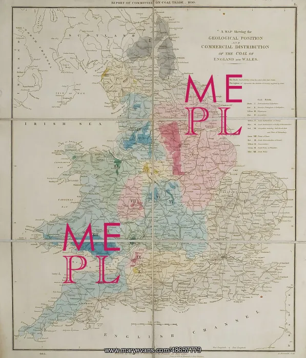
Map, Geological Position and Commercial Distribution of Coal
A map shewing the geological position and commercial distribution of the coal of England and Wales, published alongside Report from the Select Committee of the House of Lords appointed to take into consideration the state of the coal trade in the United Kingdom: with the minutes of evidence taken before the Committee, and an appendix and index'. Lithograph and watercolour, on paper. Dissected and mounted on linen
Picture No
14160571
Media ID
48657779
Size
3300px x 3868px
(1.9MB)
Credit
© The Geological Society / Mary Evans
Source
Geological Society of London - Image reference: 07-100
Date
1830
Pick your License
Alongside Appendix Appointed Consideration Dissected Distribution Evidence Geological Index Linen Lords Minutes Select Shewing
Features In These Collections
> Contributors > GSO



















![Earliest geological map of Ireland [1814]](/sq/800/earliest-geological-map-ireland-1814-48658336.jpg.webp "Earliest geological map of Ireland [1814]")



![Draft of the first geological map of Jersey [c.1828]](/sq/800/draft-first-geological-map-jersey-c1828-48658294.jpg.webp "Draft of the first geological map of Jersey [c.1828]")
![First geological map of Jersey [c.1828]](/sq/800/first-geological-map-jersey-c1828-48658274.jpg.webp "First geological map of Jersey [c.1828]")

![First Geological Map of Scotland [1808]](/sq/800/first-geological-map-scotland-1808-48658245.jpg.webp "First Geological Map of Scotland [1808]")


