
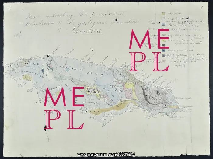
Map of Jamaica (Wall, 1864)
Map indicating the proximate distribution of the geological formations of Jamaica, by George Parkes Wall. This map was produced to accompany a paper read before the Geological Society on 9th November 1864 and published as PM Duncan and GP Wall, A Notice of the Geology of Jamaica, especially with reference to the District of Clarendon; with Descriptions of the Cretaceous, Eocene, and Miocene Corals of the Islands, Quarterly Journal of the Geological Society, vol. 21 (1865), pp.1-14. Sketch map
Picture No
14160516
Media ID
48657214
Size
5136px x 3842px
(1.8MB)
Credit
© The Geological Society / Mary Evans
Source
Geological Society of London. Archive reference: LDGSL/239 - Image reference: 07-04
Date
1864
Pick your License
Accompany Clarendon Corals Descriptions Distribution Eocene Especially Formations Geological Indicating Jamaica Journal Miocene Notice Parkes Quarterly Reference
Features In These Collections
> Contributors > GSO



















![Earliest geological map of Ireland [1814]](/sq/800/earliest-geological-map-ireland-1814-48658336.jpg.webp "Earliest geological map of Ireland [1814]")



![Draft of the first geological map of Jersey [c.1828]](/sq/800/draft-first-geological-map-jersey-c1828-48658294.jpg.webp "Draft of the first geological map of Jersey [c.1828]")
![First geological map of Jersey [c.1828]](/sq/800/first-geological-map-jersey-c1828-48658274.jpg.webp "First geological map of Jersey [c.1828]")

![First Geological Map of Scotland [1808]](/sq/800/first-geological-map-scotland-1808-48658245.jpg.webp "First Geological Map of Scotland [1808]")


