
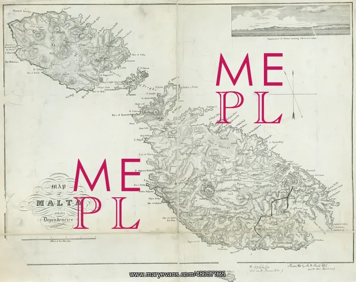
Map of Malta and its dependencies (Brocktoff 1838)
Topographical Map of Malta and its Dependencies by Luigi Brocktoff, 1838. Includes inset engraving of the Appearance of Valetta bearing S.E. 13 or 14 miles'. Produced for inclusion in George Percy Badger's guide book Description of Malta and Gozo, with printing and lithography by Matthaus Weiss (first published in 1838)
Picture No
14160646
Media ID
48657935
Size
6394px x 5079px
(9.3MB)
Credit
© The Geological Society / Mary Evans
Source
Geological Society of London. - Image reference: 07-196
Date
1838
Pick your License
1838 Dependencies Description Gozo Includes Inclusion Inset Lithography Luigi Matthaus Percy Valetta Weiss
Features In These Collections
> Contributors > GSO



















![Earliest geological map of Ireland [1814]](/sq/800/earliest-geological-map-ireland-1814-48658336.jpg.webp "Earliest geological map of Ireland [1814]")



![Draft of the first geological map of Jersey [c.1828]](/sq/800/draft-first-geological-map-jersey-c1828-48658294.jpg.webp "Draft of the first geological map of Jersey [c.1828]")
![First geological map of Jersey [c.1828]](/sq/800/first-geological-map-jersey-c1828-48658274.jpg.webp "First geological map of Jersey [c.1828]")

![First Geological Map of Scotland [1808]](/sq/800/first-geological-map-scotland-1808-48658245.jpg.webp "First Geological Map of Scotland [1808]")


