

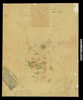
Map of the north west district of Otago, New Zealand
Reconnaissance map of north west district of the province of Otago, by James Hector. This image was produced to accompany Hector's paper On the Geology of Otago, read at the Geological Society on 7th December 1864. One section of the paper was subsequently published in Quarterly Journal of the Geological Society of London, vol. 21 (1865), pp.123-128. Printed map
Picture No
14160515
Media ID
48657213
Size
3498px x 4512px
(2.1MB)
Credit
© The Geological Society / Mary Evans
Source
Geological Society of London. Archive reference: LDGSL/242 - Image reference: 07-03
Date
1864
Pick your License
Accompany Geological Hector Hectors Journal Otago Quarterly Reconnaissance Subsequently
Features In These Collections
> Contributors > GSO





















![Earliest geological map of Ireland [1814]](/sq/800/earliest-geological-map-ireland-1814-48658336.jpg.webp "Earliest geological map of Ireland [1814]")



![Draft of the first geological map of Jersey [c.1828]](/sq/800/draft-first-geological-map-jersey-c1828-48658294.jpg.webp "Draft of the first geological map of Jersey [c.1828]")
![First geological map of Jersey [c.1828]](/sq/800/first-geological-map-jersey-c1828-48658274.jpg.webp "First geological map of Jersey [c.1828]")

![First Geological Map of Scotland [1808]](/sq/800/first-geological-map-scotland-1808-48658245.jpg.webp "First Geological Map of Scotland [1808]")


