
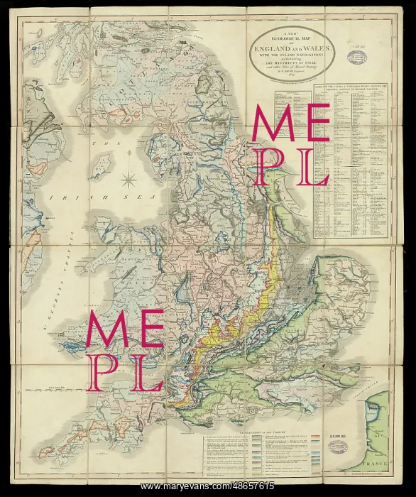
A New Geological Map of England and Wales
A New Geological Map of England and Wales, with the inland navigations exhibiting the districts of coal and other sites of mineral tonnage, by William Smith (1769-1839) and John Cary (1755-1835). Following the poor sales of William Smith's 1815 geological map A Delineation of the Strata of England and Wales, his publisher John Cary issued this smaller version. The original 1815 Map measured (when joined) 259cm x 176cm at a scale of 5 miles to the inch, with the most basic edition available for the cost of £5 5s. This new reduced map measured a more modest 74 cm x 60 cm, was at a scale of 15 miles to the inch and the cheapest edition could be had for 14 shillings " a far more commercial enterprise. How well the edition did is unclear, but it was known to have been reissued in 1820, 1824, 1827 and 1828. This copy is from 1827 but is identical to the 1820 edition. It is sectioned and mounted on linen in order to fit into a handy pocket sized box " this is the travelling edition which would have cost 18 shillings when new. Hand colouring on engraved base
Pick your License
1769-1839 1815 1824 1827 1828 Available Basic Cheapest Colouring Cost Delineation Districts Enterprise Exhibiting Geological Handy Identical Inch Inland Issued Joined Linen Measured Mineral Modest Navigations Publisher Reduced Reissued Sales Sectioned Shillings Sites Sized Smaller Strata Tonnage Unclear
Features In These Collections
> Contributors > GSO



















![Earliest geological map of Ireland [1814]](/sq/800/earliest-geological-map-ireland-1814-48658336.jpg.webp "Earliest geological map of Ireland [1814]")



![Draft of the first geological map of Jersey [c.1828]](/sq/800/draft-first-geological-map-jersey-c1828-48658294.jpg.webp "Draft of the first geological map of Jersey [c.1828]")
![First geological map of Jersey [c.1828]](/sq/800/first-geological-map-jersey-c1828-48658274.jpg.webp "First geological map of Jersey [c.1828]")

![First Geological Map of Scotland [1808]](/sq/800/first-geological-map-scotland-1808-48658245.jpg.webp "First Geological Map of Scotland [1808]")


