
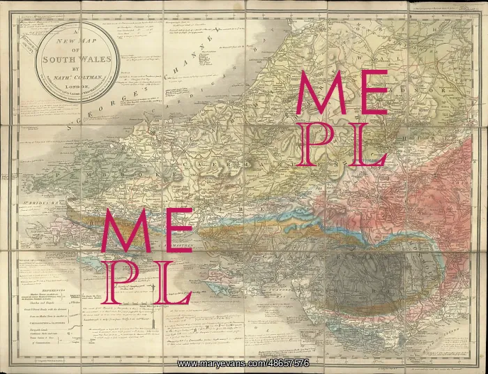
A New Map of South Wales
Geological colouring and extensive notes by George Bellas Greenough (1778-1855), on topographical base map A New Map of South Wales, by Nathaniel Coltman, published by Laurie and Whittle, 4th edition, 1813. Scale-1:300, 000. Dissected on cloth in case. The geological colouring and notes are not dated, but there are at least two notes which cite publications from 1814 and 1832, and part of the colouring is clearly based on the work of Roderick Impey Murchison from the late 1830s. The map is cited in the following article: North, F J, From the Geological Map to the Geological Survey, Transactions of the Cardiff Naturalists Society vol. 65 (1932), as being used in drafting the first edition of George Bellas Greenough's Map of England and Wales (1819), however this is probably due to the colouring mistakingly being dated as contemporary with the base map. It may have been used, however, as a draft for the second edition of Greenough's map (1839). Watercolour on engraved base
Pick your License
1778-1855 1813 1814 1819 1832 1839 Article Bellas Cardiff Cite Cited Clearly Colouring Dissected Draft Drafting Extensive Geological Greenough Greenoughs However Impey Laurie Least Murchison Nathaniel Naturalists Publications Roderick Survey Transactions Whittle
Features In These Collections
> Contributors > GSO




















![Earliest geological map of Ireland [1814]](/sq/800/earliest-geological-map-ireland-1814-48658336.jpg.webp "Earliest geological map of Ireland [1814]")



![Draft of the first geological map of Jersey [c.1828]](/sq/800/draft-first-geological-map-jersey-c1828-48658294.jpg.webp "Draft of the first geological map of Jersey [c.1828]")
![First geological map of Jersey [c.1828]](/sq/800/first-geological-map-jersey-c1828-48658274.jpg.webp "First geological map of Jersey [c.1828]")

![First Geological Map of Scotland [1808]](/sq/800/first-geological-map-scotland-1808-48658245.jpg.webp "First Geological Map of Scotland [1808]")


