
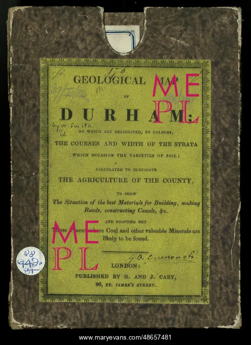
Original box and label for a Geological Map of Durham
Original box for a A New Map of Durham divided into Wards, exhibiting its Roads, Rivers, Parks, &c'. The label states Geological map of Durham: on which are delineated by colours, the courses and width of the strata which occasion the varieties of soils; calculated to elucidate the agriculture of the county, to show the situation of the best materials for building, making roads, constructing canals, &c and pointing out those places where coal and other valuable minerals are likely to be found.. The geological colouring is William Smith's (1769-1839) but is no longer acknowledged on this later issue of the map
Pick your License
1769-1839 1831 Acknowledged And C Calculated Canals Colouring Constructing Courses Delineated Divided Durham Exhibiting Geological Likely Longer Minerals Situation Soils Strata Valuable Varieties Wards Width
Features In These Collections
> Contributors > GSO



















![Earliest geological map of Ireland [1814]](/sq/800/earliest-geological-map-ireland-1814-48658336.jpg.webp "Earliest geological map of Ireland [1814]")



![Draft of the first geological map of Jersey [c.1828]](/sq/800/draft-first-geological-map-jersey-c1828-48658294.jpg.webp "Draft of the first geological map of Jersey [c.1828]")
![First geological map of Jersey [c.1828]](/sq/800/first-geological-map-jersey-c1828-48658274.jpg.webp "First geological map of Jersey [c.1828]")

![First Geological Map of Scotland [1808]](/sq/800/first-geological-map-scotland-1808-48658245.jpg.webp "First Geological Map of Scotland [1808]")


