
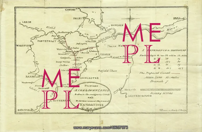
Plan of the Proposed Aire and Dunn Canal
Printed plan of The Proposed Aire and Dunn Canal to drain the contiguous Lands and to shorten and connect the present navigations, by William Smith (1769-1839), Engineer, 1819. Drawn on stone by J[ohn] Phillips. The lithograph map was drawn by William Smith's nephew John Phillips who had set up a small (short lived) printing business out of his uncle's house in Buckingham Street, London. The bill for the proposed canal was brought before the House of Commons in April 1819, but was rejected. The canal was never constructed. Lithograph
Picture No
14160590
Media ID
48657873
Size
8410px x 5498px
(12.3MB)
Credit
© The Geological Society / Mary Evans
Source
Geological Society of London. Archive reference: LDGSL/748 - Image reference: 07-130
Date
1819
Pick your License
1769-1839 1819 Aire Connect Constructed Contiguous Drain Dunn Lands Lived Navigations Nephew Proposed Rejected Shorten Uncles
Features In These Collections
> Contributors > GSO



















![Earliest geological map of Ireland [1814]](/sq/800/earliest-geological-map-ireland-1814-48658336.jpg.webp "Earliest geological map of Ireland [1814]")



![Draft of the first geological map of Jersey [c.1828]](/sq/800/draft-first-geological-map-jersey-c1828-48658294.jpg.webp "Draft of the first geological map of Jersey [c.1828]")
![First geological map of Jersey [c.1828]](/sq/800/first-geological-map-jersey-c1828-48658274.jpg.webp "First geological map of Jersey [c.1828]")

![First Geological Map of Scotland [1808]](/sq/800/first-geological-map-scotland-1808-48658245.jpg.webp "First Geological Map of Scotland [1808]")


