
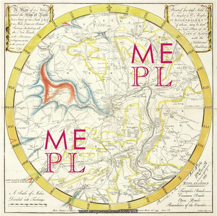
Reconstruction of William Smith's Geological Map of Bath
Reconstruction of William Smith's geological map of Bath (1799) in order to illustrate how the image may have looked when first created. With thanks to Dan Brown, Bath in www. bathintime. co. uk Derived in part from material provided by the British Geological Survey @ NERC and Bath Central Library. Digital file
Picture No
14160597
Media ID
48657513
Size
3747px x 3731px
(2.6MB)
Credit
© The Geological Society / Mary Evans
Source
Geological Society of London. Archive reference: LDGSL/742a - Image reference: 07-136
Date
1799, 1897, 2014
Pick your License
1799 Derived File Geological Illustrate Looked Provided Survey Thanks
Features In These Collections
> Contributors > GSO



















![Earliest geological map of Ireland [1814]](/sq/800/earliest-geological-map-ireland-1814-48658336.jpg.webp "Earliest geological map of Ireland [1814]")



![Draft of the first geological map of Jersey [c.1828]](/sq/800/draft-first-geological-map-jersey-c1828-48658294.jpg.webp "Draft of the first geological map of Jersey [c.1828]")
![First geological map of Jersey [c.1828]](/sq/800/first-geological-map-jersey-c1828-48658274.jpg.webp "First geological map of Jersey [c.1828]")

![First Geological Map of Scotland [1808]](/sq/800/first-geological-map-scotland-1808-48658245.jpg.webp "First Geological Map of Scotland [1808]")


