
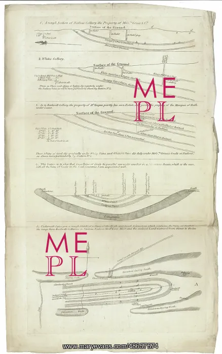
Sections and plan of the collieries around Nailsea
Sections and plans of the collieries around Nailsea, which accompanied the pamphlet The Reports of Mr William Smith (1769-1839), and Mr Edward Martin, to the Bristol and Taunton Canal Company, (1818). In the report, Smith was of the opinion that there was a sufficient supply of workable coal to justify the construction of a new canal. Only the Bridgewater-Taunton part of the canal was constructed, opening in 1827. Engraving on paper
Picture No
14160603
Media ID
48657574
Size
4120px x 6589px
(4.2MB)
Credit
© The Geological Society / Mary Evans
Source
Geological Society of London. Archive reference: LDGSL/745 - Image reference: 07-144
Date
1811
Pick your License
1769-1839 1811 1818 1827 Collieries Constructed Justify Opinion Pamphlet Reports Sections Sufficient Taunton
Features In These Collections
> Contributors > GSO



















![Earliest geological map of Ireland [1814]](/sq/800/earliest-geological-map-ireland-1814-48658336.jpg.webp "Earliest geological map of Ireland [1814]")



![Draft of the first geological map of Jersey [c.1828]](/sq/800/draft-first-geological-map-jersey-c1828-48658294.jpg.webp "Draft of the first geological map of Jersey [c.1828]")
![First geological map of Jersey [c.1828]](/sq/800/first-geological-map-jersey-c1828-48658274.jpg.webp "First geological map of Jersey [c.1828]")

![First Geological Map of Scotland [1808]](/sq/800/first-geological-map-scotland-1808-48658245.jpg.webp "First Geological Map of Scotland [1808]")


