
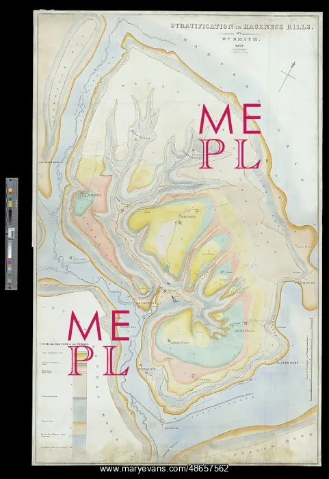
Stratification in Hackness Hills (Smith, 1832)
This map is William Smith's last major work. Undertaken when he employed as a land steward to Sir John Johnstone, it was drawn at a scale of 6 inches to the mile and is considered to be one of the earliest large scale geological maps constructed. Hand colouring on lithograph base map on paper
Picture No
14160602
Media ID
48657562
Size
8217px x 11975px
(12.1MB)
Credit
© The Geological Society / Mary Evans
Source
Geological Society of London. Archive reference: LDGSL/751 - Image reference: 07-143B
Date
1832
Pick your License
1832 Colouring Considered Constructed Earliest Employed Geological Inches Johnstone Steward Stratification Undertaken
Features In These Collections
> Contributors > GSO



















![Earliest geological map of Ireland [1814]](/sq/800/earliest-geological-map-ireland-1814-48658336.jpg.webp "Earliest geological map of Ireland [1814]")



![Draft of the first geological map of Jersey [c.1828]](/sq/800/draft-first-geological-map-jersey-c1828-48658294.jpg.webp "Draft of the first geological map of Jersey [c.1828]")
![First geological map of Jersey [c.1828]](/sq/800/first-geological-map-jersey-c1828-48658274.jpg.webp "First geological map of Jersey [c.1828]")

![First Geological Map of Scotland [1808]](/sq/800/first-geological-map-scotland-1808-48658245.jpg.webp "First Geological Map of Scotland [1808]")


