
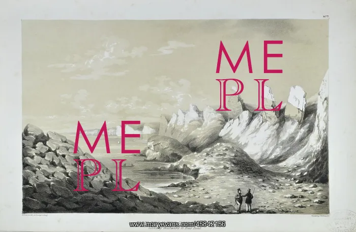
View from the New Beach looking Westward to Beer Head
View from the New Beach looking Westward to Beer Head, lithographed by George Scharf after drawing by William Dawson. The Axmouth-Lyme Regis stretch of the south coast of England comprises one of the best known areas of landslipping in Great Britain. It includes the site of the first large-scale landslide ever to have been the subject of detailed scientific description by geologists: the Great Bindon Landslide which happened on Christmas Day, 1839. Fortuitously William Buckland (1784-1856) and his scientific artist wife Mary nee Morland (1797-1857) were quickly on the spot as they had been visiting fellow geologist Wiliam Daniel Conybeare (1787-1857) in nearby Axminster. The three, along with Mary Anning (1799-1847), investigated the incident. Coloured lithograph
Pick your License
1784-1856 1787-1857 1797-1857 1799-1847 1839 Anning Axminster Axmouth-lyme Bindon Buckland Comprises Conybeare Description Detailed Fellow Fortuitously Geologist Geologists Happened Incident Includes Investigated Landslide Landslipping Large-scale Lithographed Morland Nearby Quickly Regis Scharf Stretch Westward Wiliam
Features In These Collections
> Contributors > GSO



















![Earliest geological map of Ireland [1814]](/sq/800/earliest-geological-map-ireland-1814-48658336.jpg.webp "Earliest geological map of Ireland [1814]")



![Draft of the first geological map of Jersey [c.1828]](/sq/800/draft-first-geological-map-jersey-c1828-48658294.jpg.webp "Draft of the first geological map of Jersey [c.1828]")
![First geological map of Jersey [c.1828]](/sq/800/first-geological-map-jersey-c1828-48658274.jpg.webp "First geological map of Jersey [c.1828]")

![First Geological Map of Scotland [1808]](/sq/800/first-geological-map-scotland-1808-48658245.jpg.webp "First Geological Map of Scotland [1808]")


