
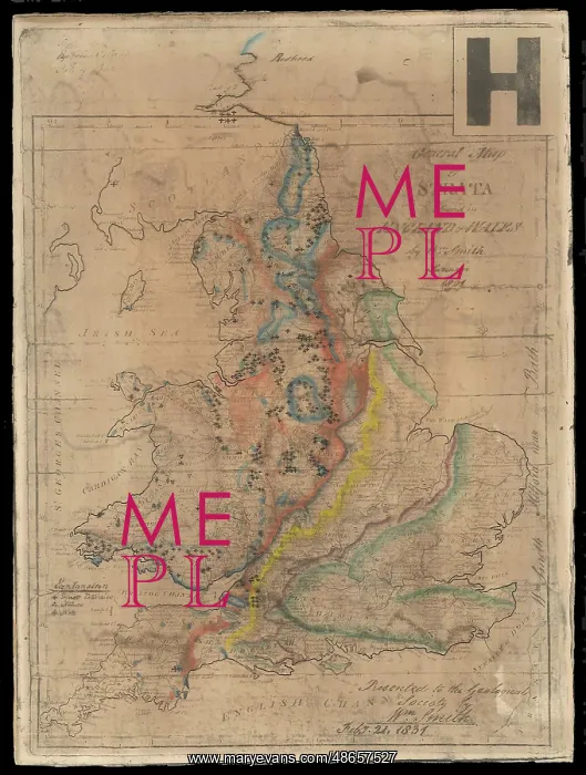
William Smith's General Map of Strata
Photographic facsimile reconstructing of William Smith's General Map of Strata found in England and Wales (1801), commissioned by John Wesley Judd, and coloured by Miss Margaret Reekes, 1897. Hand colouring on photographic reproduction on board
Picture No
14160599
Media ID
48657527
Size
3102px x 4108px
(1.7MB)
Credit
© The Geological Society / Mary Evans
Source
Geological Society of London. Archive reference: LDGSL/743 - Image reference: 07-138
Date
1801, 1897
Pick your License
1801 Colouring Commissioned Facsimile Judd Reconstructing Reproduction Strata Wesley
Features In These Collections
> Contributors > GSO



















![Earliest geological map of Ireland [1814]](/sq/800/earliest-geological-map-ireland-1814-48658336.jpg.webp "Earliest geological map of Ireland [1814]")



![Draft of the first geological map of Jersey [c.1828]](/sq/800/draft-first-geological-map-jersey-c1828-48658294.jpg.webp "Draft of the first geological map of Jersey [c.1828]")
![First geological map of Jersey [c.1828]](/sq/800/first-geological-map-jersey-c1828-48658274.jpg.webp "First geological map of Jersey [c.1828]")

![First Geological Map of Scotland [1808]](/sq/800/first-geological-map-scotland-1808-48658245.jpg.webp "First Geological Map of Scotland [1808]")


