
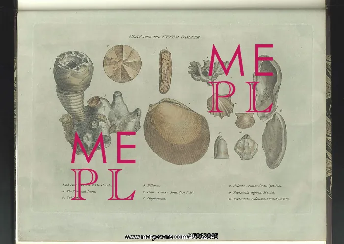
Clay over the Upper Oolite fossils
Clay over the Upper Oolite fossils, by James Sowerby (1757-1822) for William Smith (1769-1839). Depictions of characteristic fossils found in Clay over the Upper Oolite stratum. Smith was the first person to recognise the importance of fossils in identifying strata of equivalent age, thus enabling rocks to be correlated across country. His work as a surveyor and engineer involved him travelling up and down the country during which he accumulated a large collection of characteristic fossils of the British strata. Smith sold his fossil collection to the British Museum and this publication is part catalogue/part explanation of his collection and theories, the illustrations (by the natural history illustrator James Sowerby) printed on coloured paper to correlate with the geological colouring on his 1815 map of England and Wales. Hand coloured engraving
Pick your License
1757-1822 1769-1839 1815 1816-1819 Accumulated Catalogue Part Characteristic Colouring Correlate Correlated Depictions Enabling Equivalent Explanation Fossils Geological Identifying Illustrator Importance Involved Oolite Recognise Sowerby Strata Stratum Surveyor Theories Thus
Features In These Collections
> Contributors > GSO



















![Earliest geological map of Ireland [1814]](/sq/800/earliest-geological-map-ireland-1814-48658336.jpg.webp "Earliest geological map of Ireland [1814]")



![Draft of the first geological map of Jersey [c.1828]](/sq/800/draft-first-geological-map-jersey-c1828-48658294.jpg.webp "Draft of the first geological map of Jersey [c.1828]")
![First geological map of Jersey [c.1828]](/sq/800/first-geological-map-jersey-c1828-48658274.jpg.webp "First geological map of Jersey [c.1828]")

![First Geological Map of Scotland [1808]](/sq/800/first-geological-map-scotland-1808-48658245.jpg.webp "First Geological Map of Scotland [1808]")


