
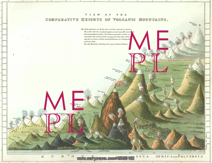
Comparative heights of volcanic mountains
View of the comparative heights of volcanic mountains, by Engraved by J and J Neele for Charles Daubeny (1795-1867). Print showing a comparative view of heights of the world's different volcanoes, detail of a larger print, A Tabular View of Volcanic Phaenomena comprising a list of the Burning Mountains that have been noticed at any time since the commencement of Historical records or which appear to have existed at antecedent periods together with dates of their respective eruptions and of the principal earthquakes connected with them by Charles Daubeny, MD, FRS, Professor of Chemistry in the University of Oxford, intended as a companion to the Description of active and ancient Volcanos (sic) lately published by the same author, published by J Vincent, Oxford and William Phillips, London, (1827). Hand coloured engraving
Pick your License
1827 Appear Chemistry Commencement Companion Comparative Comprising Connected Dates Description Earthquakes Eruptions Existed Geological Heights Intended Larger Lately Neele Noticed Periods Respective Tabular Volcanic Volcanoes Volcanos
Features In These Collections
> Contributors > GSO



















![Earliest geological map of Ireland [1814]](/sq/800/earliest-geological-map-ireland-1814-48658336.jpg.webp "Earliest geological map of Ireland [1814]")



![Draft of the first geological map of Jersey [c.1828]](/sq/800/draft-first-geological-map-jersey-c1828-48658294.jpg.webp "Draft of the first geological map of Jersey [c.1828]")
![First geological map of Jersey [c.1828]](/sq/800/first-geological-map-jersey-c1828-48658274.jpg.webp "First geological map of Jersey [c.1828]")

![First Geological Map of Scotland [1808]](/sq/800/first-geological-map-scotland-1808-48658245.jpg.webp "First Geological Map of Scotland [1808]")


