
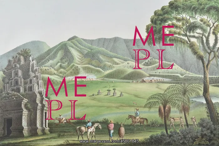
Dieng Plateau, Java
Plateau-Diong ('Dieng plateau'), by Franz Wilhelm Junghuhn, Winckelmann and Sohne. Lithograph of the Dieng plateau on the island of Java, Indonesia. It is a marshy plateau in the Dieng volcanic complex. To the left of the picture is one of the Dieng temples - there are eight of these, but it is thought that in the past there were as many as 400, built during the 7th-9th centuries. When they were rediscovered in the 19th century, they were partially submerged in a lake. Lithograph
Picture No
14154481
Media ID
45861845
Size
5917px x 3936px
(3.9MB)
Credit
© The Geological Society / Mary Evans
Source
Geological Society of London. Published in Junghuhn's Landschaften-Atlas zu Java', which accompanied his four volume Java: deszelfs gedaante, bekleeding en inwendige struktuur (Java: its shape, vegetation cover and inner construction)', (Amsterdam: PN Van Kampen, 1850-1854). - Image reference: 09-20a
Date
1850-1854
Pick your License
1850-1854 Centuries Java Junghuhn Marshy Partially Plateau Rediscovered Sohne Submerged Temples Volcanic Winckelmann
Features In These Collections
> Contributors > GSO



















![Earliest geological map of Ireland [1814]](/sq/800/earliest-geological-map-ireland-1814-48658336.jpg.webp "Earliest geological map of Ireland [1814]")



![Draft of the first geological map of Jersey [c.1828]](/sq/800/draft-first-geological-map-jersey-c1828-48658294.jpg.webp "Draft of the first geological map of Jersey [c.1828]")
![First geological map of Jersey [c.1828]](/sq/800/first-geological-map-jersey-c1828-48658274.jpg.webp "First geological map of Jersey [c.1828]")

![First Geological Map of Scotland [1808]](/sq/800/first-geological-map-scotland-1808-48658245.jpg.webp "First Geological Map of Scotland [1808]")


