
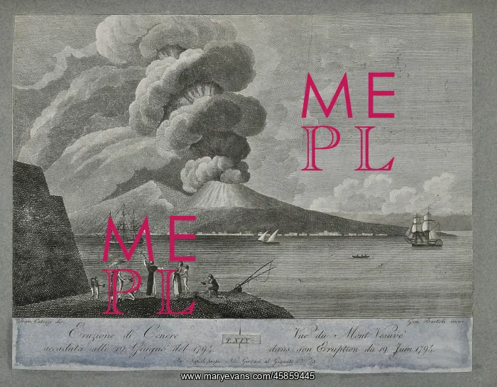
Eruption of ash from Mount Vesuvius, 19 June 1794
Eruption of ash from Mount Vesuvius, 19 June 1794, by Francesco Catozzi, engraved by Gennaro Bartoli. Eruzione di Cenere accaduta alli 19 Giugno del 1794 (Eruption of ash which occurred on the 19 June 1794). Engraving
Picture No
14154191
Media ID
45859445
Size
4654px x 3627px
(3.5MB)
Credit
© The Geological Society / Mary Evans
Source
Geological Society of London. Tour, Duc de la, Recueil de toutes les vues qui existoient dans le cabinet du Duc de la Tour et qui representoient les incendies du Mont Vesuve arrives jusqu' present. Avec les descriptions correspondantes tirees pour la premiere fois de l'histoire on y a ajoute aussi les deux lettres de Pline le jeune, ou l'on parle du premier incendie arrive l'an 79 de l'Ere Chretienne', Naples: Chez Nicolas Gervasi (1805). Plate 19. - Image reference: 02-63
Date
1805



















![Earliest geological map of Ireland [1814]](/sq/800/earliest-geological-map-ireland-1814-48658336.jpg.webp "Earliest geological map of Ireland [1814]")



![Draft of the first geological map of Jersey [c.1828]](/sq/800/draft-first-geological-map-jersey-c1828-48658294.jpg.webp "Draft of the first geological map of Jersey [c.1828]")
![First geological map of Jersey [c.1828]](/sq/800/first-geological-map-jersey-c1828-48658274.jpg.webp "First geological map of Jersey [c.1828]")

![First Geological Map of Scotland [1808]](/sq/800/first-geological-map-scotland-1808-48658245.jpg.webp "First Geological Map of Scotland [1808]")


