
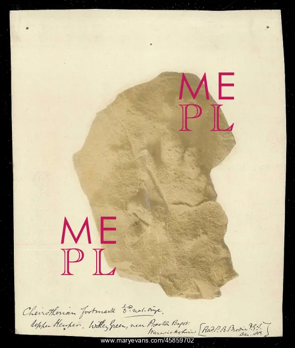
Footprint of a Chierotherium
Photograph of a Cheirotherium footprint from the Upper Keuper, Whitley Green, near Preston Bagot, Warwickshire, by Peter Bellinger Brodie (1815-1897). Shown one third size. The footprints of this extinct animal were first found in 1834, however the five-toed nature of the prints, especially as one of the toes looked like a thumb, caused confusion in regards to what the animal actually was as no other remains apart from footprints have been found. It is now considered to be an early ancestor of the crocodile. Black and white photograph, albumen print
Pick your License
1834 Actually Ancestor Apart Bagot Bellinger Brodie Caused Confusion Considered Crocodile Especially Footprint Footprints Fossils Geological However Keuper Looked Regards Thumb Toes Trace Warwickshire Whitley
Features In These Collections
> Contributors > GSO



















![Earliest geological map of Ireland [1814]](/sq/800/earliest-geological-map-ireland-1814-48658336.jpg.webp "Earliest geological map of Ireland [1814]")



![Draft of the first geological map of Jersey [c.1828]](/sq/800/draft-first-geological-map-jersey-c1828-48658294.jpg.webp "Draft of the first geological map of Jersey [c.1828]")
![First geological map of Jersey [c.1828]](/sq/800/first-geological-map-jersey-c1828-48658274.jpg.webp "First geological map of Jersey [c.1828]")

![First Geological Map of Scotland [1808]](/sq/800/first-geological-map-scotland-1808-48658245.jpg.webp "First Geological Map of Scotland [1808]")


