
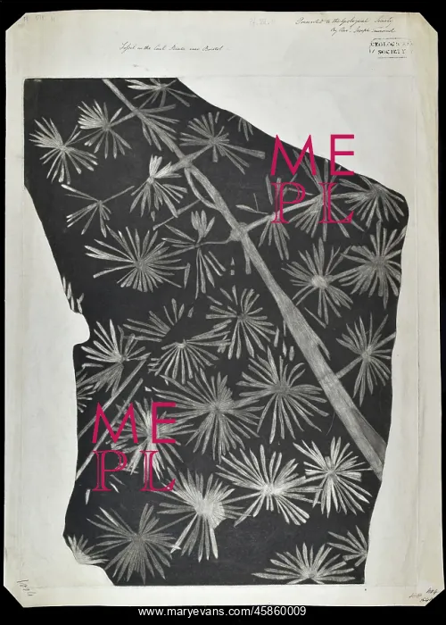
Fossil horsetail from Bristol
Fossil horsetail from the Bristol coal measures, by Joseph Townsend (1739-1816)/William Smith (1769-1839). Print of a fossil horsetail (Annularia) from the Coal Measures of Dunkerton, near Bristol, (c. 1808). Although the print was presented to the Society by the Reverend Joseph Townsend, 10 April 1815, his friend William Smith gave the Linnean Society a copy of the same print in 1808, which contains a manuscript note which reads Impression of a plant from Dunkerton Coal Pit near Bath... It is unclear which man (if any) instigated the copy. Mezzotint
Picture No
14154239
Media ID
45860009
Size
4000px x 5598px
(2.7MB)
Credit
© The Geological Society / Mary Evans
Source
Geological Society of London. Archive reference: LDGSL/558 - Image reference: 04-20
Date
1808
Pick your License
1769-1839 1808 1815 Although Contains Fossils Geological Horsetail Impression Instigated Linnean Measures Mezzotint Palaeontology Reverend Townsend Unclear
Features In These Collections
> Contributors > GSO



















![Earliest geological map of Ireland [1814]](/sq/800/earliest-geological-map-ireland-1814-48658336.jpg.webp "Earliest geological map of Ireland [1814]")



![Draft of the first geological map of Jersey [c.1828]](/sq/800/draft-first-geological-map-jersey-c1828-48658294.jpg.webp "Draft of the first geological map of Jersey [c.1828]")
![First geological map of Jersey [c.1828]](/sq/800/first-geological-map-jersey-c1828-48658274.jpg.webp "First geological map of Jersey [c.1828]")

![First Geological Map of Scotland [1808]](/sq/800/first-geological-map-scotland-1808-48658245.jpg.webp "First Geological Map of Scotland [1808]")


