
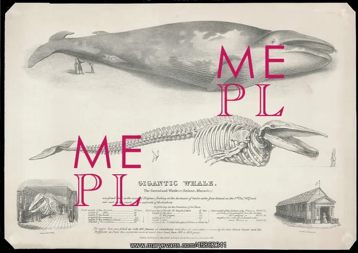
The Gigantic Greenland Whale
Print, by George Johann Scharf (1788-1860) of the Gigantic Whale, The Greenland whale (or Baloena Musculus) was found dead on the coast of Belgium, floating at a distance of twelve miles from Ostend, on the 3rd November 1827 and was cast on the sands on the east side of the harbour..The upper jaw was fitted up with 800 fanons or whalebones and from the calculations made by the late Baron Cuvier and the Professors in Paris this enormous animal must have lived from 900-1000 years. On the lower left and lower right of the print, is the exterior and interior of what seems to be a specially constructed viewing building to house the skeleton. The whale was exhibited in London in 1832. Lithograph
Picture No
14154528
Media ID
45862341
Size
5818px x 4115px
(5.6MB)
Credit
© The Geological Society / Mary Evans
Source
Geological Society of London. Archive reference: LDGSL/649 - Image reference: 10-06
Date
1832



















![Earliest geological map of Ireland [1814]](/sq/800/earliest-geological-map-ireland-1814-48658336.jpg.webp "Earliest geological map of Ireland [1814]")



![Draft of the first geological map of Jersey [c.1828]](/sq/800/draft-first-geological-map-jersey-c1828-48658294.jpg.webp "Draft of the first geological map of Jersey [c.1828]")
![First geological map of Jersey [c.1828]](/sq/800/first-geological-map-jersey-c1828-48658274.jpg.webp "First geological map of Jersey [c.1828]")

![First Geological Map of Scotland [1808]](/sq/800/first-geological-map-scotland-1808-48658245.jpg.webp "First Geological Map of Scotland [1808]")


