
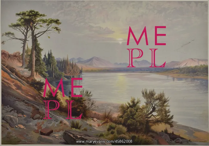
Head of Yellowstone River
Head of Yellowstone River, by Louis Prang and Company after original watercolour by Thomas Moran. Yellowstone Park, Wyoming, USA, was declared the world's first national park in 1872. Although well known to tribes and trackers for centuries, it only came to national prominence following the more formal scientific surveys conducted from the 1860s onwards. The most famous was that led by Ferdinand Vandeever Hayden (1829-1887), head of the US Geological and Geographical Survey of the Territories in 1871. Included in Hayden's scientific team were the artist Thomas Moran (1837-1926) and photographer William Henry Jackson (1843-1942). The initial report, published in the autumn of 1871, alongside the stunning scenery captured by Moran and Jackson were instrumental to the US Congress decision to establish Yellowstone as a national park. Chromolithograph
Pick your License
1829-1887 1837-1926 1843-1942 Alongside Although Centuries Conducted Decision Declared Establish Geological Haydens Initial Instrumental Moran Onwards Prang Prominence Stunning Survey Surveys Territories Trackers Tribes Vandeever Wyoming Yellowstone
Features In These Collections
> Contributors > GSO



















![Earliest geological map of Ireland [1814]](/sq/800/earliest-geological-map-ireland-1814-48658336.jpg.webp "Earliest geological map of Ireland [1814]")



![Draft of the first geological map of Jersey [c.1828]](/sq/800/draft-first-geological-map-jersey-c1828-48658294.jpg.webp "Draft of the first geological map of Jersey [c.1828]")
![First geological map of Jersey [c.1828]](/sq/800/first-geological-map-jersey-c1828-48658274.jpg.webp "First geological map of Jersey [c.1828]")

![First Geological Map of Scotland [1808]](/sq/800/first-geological-map-scotland-1808-48658245.jpg.webp "First Geological Map of Scotland [1808]")


