
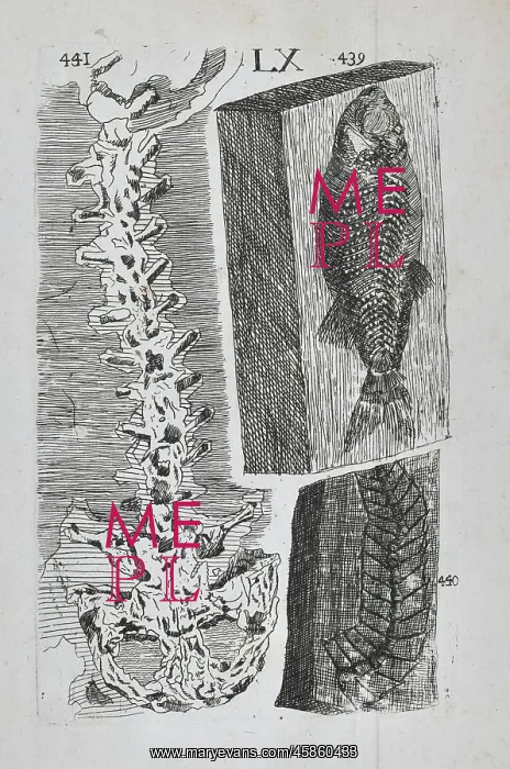
Homo diluvii testis
Homo diluvii testis, by Creator: Unknown. The image on the left, marked 441, shows a fossil which was found in a limestone quarry in Ohningen, Germany. It was first described by the Swiss naturalist Johan Jakob Scheuchzer (1672-1733) who claimed it to be the spine and pelvis of a child which had been trampled during the Biblical Flood. It was named Homo diluvii testis which translated as man, witness of the Flood'. In 1811, the French naturalist Georges Cuvier (1769-1832) picked away at some of the fossil revealing the forelimbs. He identified it as being a giant salamander. It would later be renamed Andrias scheuchzeri in honour of its original describer. Engraving
Pick your License
1742 1811 Claimed Creator Cuvier Described Fake Fossils Geological Homo Identified Jakob Johan Limestone Naturalist Palaeontology Pelvis Picked Quarry Renamed Revealing Salamander Scheuchzer Spine Trampled Translated Witness
Features In These Collections
> Contributors > GSO





















![Earliest geological map of Ireland [1814]](/sq/800/earliest-geological-map-ireland-1814-48658336.jpg.webp "Earliest geological map of Ireland [1814]")



![Draft of the first geological map of Jersey [c.1828]](/sq/800/draft-first-geological-map-jersey-c1828-48658294.jpg.webp "Draft of the first geological map of Jersey [c.1828]")
![First geological map of Jersey [c.1828]](/sq/800/first-geological-map-jersey-c1828-48658274.jpg.webp "First geological map of Jersey [c.1828]")

![First Geological Map of Scotland [1808]](/sq/800/first-geological-map-scotland-1808-48658245.jpg.webp "First Geological Map of Scotland [1808]")


