
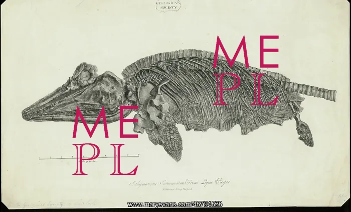
Ichthyosaurus Intermedius from Lyme Regis
Ichthyosaurus Intermedius from Lyme Regis, by N Whittock. The print is one of three given to the Geological Society on 30 November 1827 by Lord William Willoughby Cole, later 3rd Earl of Enniskillen. The prints are likely to have been commissioned by Cole to show off specimens from his own collection. Short run lithographic prints of fossils to be distributed to friends and colleagues were extremely popular during this period. Chalk lithograph
Picture No
14154219
Media ID
45794533
Size
5716px x 3454px
(3.5MB)
Credit
© The Geological Society / Mary Evans
Source
Geological Society of London. Archive reference: LDGSL/580 - Image reference: 03-21
Date
1827
Pick your License
1827 Chalk Colleagues Commissioned Distributed Enniskillen Extremely Fossilss Geological Ichthyosaurus Intermedius Likely Lithographic Lyme Regis Reptiles Specimens Willoughby
Features In These Collections
> Contributors > GSO



















![Earliest geological map of Ireland [1814]](/sq/800/earliest-geological-map-ireland-1814-48658336.jpg.webp "Earliest geological map of Ireland [1814]")



![Draft of the first geological map of Jersey [c.1828]](/sq/800/draft-first-geological-map-jersey-c1828-48658294.jpg.webp "Draft of the first geological map of Jersey [c.1828]")
![First geological map of Jersey [c.1828]](/sq/800/first-geological-map-jersey-c1828-48658274.jpg.webp "First geological map of Jersey [c.1828]")

![First Geological Map of Scotland [1808]](/sq/800/first-geological-map-scotland-1808-48658245.jpg.webp "First Geological Map of Scotland [1808]")


