
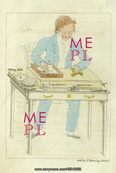
Instructions for using the Lapidary's Apparatus
Illustrative plate demonstrating the use of Lapidary's Apparatus, for John Mawe (1766-1829), possibly by James Sowerby (1757-1822). This compact Lapidary's Mill was contained in a small mahogany box which could be placed on a parlour table, and worked without any inconvenience.. Hand coloured engraving
Picture No
14154267
Media ID
45842055
Size
1038px x 1545px
(376KB)
Credit
© The Geological Society / Mary Evans
Source
Geological Society of London. Mawe, John, Familiary Lessons on Mineralogy and Geology: with colored plates to which is added a practical description of the use of the Lapidary's Apparatus, explaining the methods of slitting and polishing pebbles, etc', Printed and sold by the author, 1822. - Image reference: 04-48
Date
1822
Pick your License
1757-1822 1822 Compact Contained Demonstrating Geological Illustrative Inconvenience Lapidary Mahogany Mineralogy Parlour Placed Sowerby
Features In These Collections
> Contributors > GSO



















![Earliest geological map of Ireland [1814]](/sq/800/earliest-geological-map-ireland-1814-48658336.jpg.webp "Earliest geological map of Ireland [1814]")



![Draft of the first geological map of Jersey [c.1828]](/sq/800/draft-first-geological-map-jersey-c1828-48658294.jpg.webp "Draft of the first geological map of Jersey [c.1828]")
![First geological map of Jersey [c.1828]](/sq/800/first-geological-map-jersey-c1828-48658274.jpg.webp "First geological map of Jersey [c.1828]")

![First Geological Map of Scotland [1808]](/sq/800/first-geological-map-scotland-1808-48658245.jpg.webp "First Geological Map of Scotland [1808]")


