
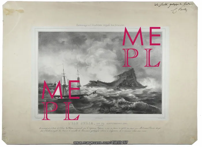
L'ile Julia (Julia's Isle)
L'Ile Julia le 29 Septembre 1831 (Julia's Isle on 29 September 1831), after Edmond Joinville (1801-1849). Julia's Isle was a submerged volcanic island which, when it temporarily appeared in July 1831 off the coast of Sicily, caused an international dispute over which country had sovereignty, as well as confusion as to its naming. In August 1831, Humphrey Fleming Senhouse, a British naval captain, claimed it for Britain and named it Graham's Island after Sir James Graham, first lord of the Admiralty. However when the French geologist Louis-Constant Prevost described the formation for the Societe Geologique de France, he named it Julia's Isle after its July appearance " and it was under this name France tried to claim territorial ownership. King Ferdinand of the Two Sicilies, sent ships to Ferdinandea to claim it for the Bourbon crown. Lithograph
Pick your License
1831 1832 Admiralty Appeared Bourbon Caused Claim Claimed Confusion Described Dispute Edmond Fleming Geological Geologique Geologist However Joinville Naming Ownership Prevost Septembre Sicilies Societe Sovereignty Submerged Temporarily Territorial Tried Volcanic
Features In These Collections
> Contributors > GSO



















![Earliest geological map of Ireland [1814]](/sq/800/earliest-geological-map-ireland-1814-48658336.jpg.webp "Earliest geological map of Ireland [1814]")



![Draft of the first geological map of Jersey [c.1828]](/sq/800/draft-first-geological-map-jersey-c1828-48658294.jpg.webp "Draft of the first geological map of Jersey [c.1828]")
![First geological map of Jersey [c.1828]](/sq/800/first-geological-map-jersey-c1828-48658274.jpg.webp "First geological map of Jersey [c.1828]")

![First Geological Map of Scotland [1808]](/sq/800/first-geological-map-scotland-1808-48658245.jpg.webp "First Geological Map of Scotland [1808]")


