
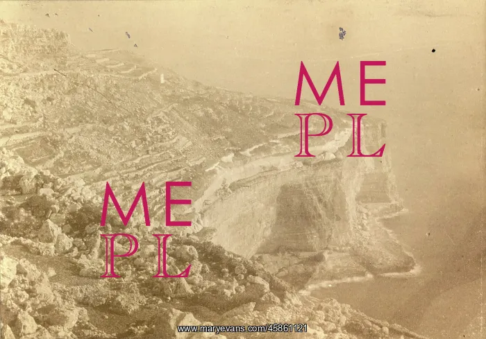
Malta Beds from Gebel Ciantar
From Gebel Ciantar. Shewing the whole series of the Malta Beds, by John Henry Cooke. Photo in which the layers of sedimentary rock (beds) on Malta can be seen in the cliffs. You can also see the traditional terraced fields on the clifftops. Gebel Ciantar is an area near Dingli Cliffs, in the southwest of the island, formerly the site of a Bronze Age village. Black and white albumen photograph
Picture No
14154361
Media ID
45861121
Size
3503px x 2447px
(1.9MB)
Credit
© The Geological Society / Mary Evans
Source
Geological Society of London. Archive reference: LDGSL/936/13 - Image reference: 05-34
Date
1893-1894
Pick your License
Beds Cooke Formerly Gebel Geological Layers Sedimentary Shewing Southwest Terraced
Features In These Collections
> Contributors > GSO



















![Earliest geological map of Ireland [1814]](/sq/800/earliest-geological-map-ireland-1814-48658336.jpg.webp "Earliest geological map of Ireland [1814]")



![Draft of the first geological map of Jersey [c.1828]](/sq/800/draft-first-geological-map-jersey-c1828-48658294.jpg.webp "Draft of the first geological map of Jersey [c.1828]")
![First geological map of Jersey [c.1828]](/sq/800/first-geological-map-jersey-c1828-48658274.jpg.webp "First geological map of Jersey [c.1828]")

![First Geological Map of Scotland [1808]](/sq/800/first-geological-map-scotland-1808-48658245.jpg.webp "First Geological Map of Scotland [1808]")


