
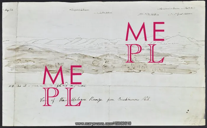
Malvern Range from Crookbarrow Hill
Sketch of the Malvern range of hills, seen from Crookbarrow (formerly Cruckbarrow) hill, by Charlotte Murchison. The hills are formed from some of the oldest rocks in England, and are known for producing Malvern spring water. The names of some of them are given at the top of the picture. Ink and pencil sketch
Picture No
14154307
Media ID
45800610
Size
5305px x 3305px
(1.7MB)
Credit
© The Geological Society / Mary Evans
Source
Geological Society of London. Archive reference: LDGSL/857/2 - Image reference: 05-01
Date
1834-1838
Pick your License
Formed Formerly Geological Malvern Murchison Names Oldest Producing
Features In These Collections
> Contributors > GSO



















![Earliest geological map of Ireland [1814]](/sq/800/earliest-geological-map-ireland-1814-48658336.jpg.webp "Earliest geological map of Ireland [1814]")



![Draft of the first geological map of Jersey [c.1828]](/sq/800/draft-first-geological-map-jersey-c1828-48658294.jpg.webp "Draft of the first geological map of Jersey [c.1828]")
![First geological map of Jersey [c.1828]](/sq/800/first-geological-map-jersey-c1828-48658274.jpg.webp "First geological map of Jersey [c.1828]")

![First Geological Map of Scotland [1808]](/sq/800/first-geological-map-scotland-1808-48658245.jpg.webp "First Geological Map of Scotland [1808]")


