
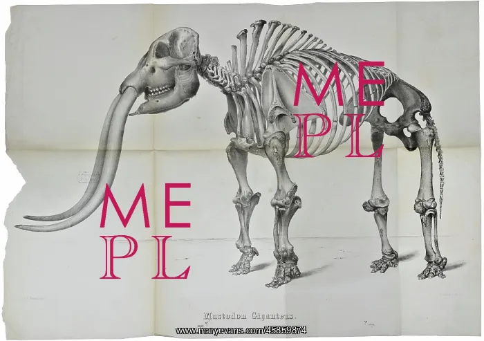
Mastodon giganteus
Mastodon giganteus, lithographed by J H Bufford and Co. The image is from a book dedicated to a description of this fossil skeleton which was found in Newburgh, in the state of New York in 1845. The valley in which the Mastodon was found, was part of the land belong to the farm of a Mr N Brewster. The summer of 1845 had been unusually dry and the valley, which was normally wet and swampy, dried out to expose small lacustrine deposits which Brewster wanted to use as fertiliser. The book recounts how Brewster's labourers dug through a thickness of two feet of a peat-bog then a layer of red moss about a foot thick, and finally fell upon a bed of shell-marl. After raising about a foot of this they struck on something hard. Brewster, his son William, his son-in-law Mr Weeks accompanied by a large number of neighbours and other visitors, returned to the spot the next day to excavate the skeleton. The bones were cleaned and dried and then articulated by a local physician Dr Prime. The specimen was subsequently sent onto New York where it was acquired by the surgeon John Collins Warren (1778-1856)
Pick your License
1852 Acquired Articulated Belong Bones Brewster Bufford Cleaned Dedicated Deposits Description Dried Excavate Expose Fertiliser Finally Fossils Geological Giganteus Labourers Lacustrine Layer Lithographed Mastodon Neighbours Newburgh Normally Onto Raising Recounts Returned Son-in-law Struck Subsequently Surgeon Swampy Thick Thickness Unusually
Features In These Collections
> Contributors > GSO



















![Earliest geological map of Ireland [1814]](/sq/800/earliest-geological-map-ireland-1814-48658336.jpg.webp "Earliest geological map of Ireland [1814]")



![Draft of the first geological map of Jersey [c.1828]](/sq/800/draft-first-geological-map-jersey-c1828-48658294.jpg.webp "Draft of the first geological map of Jersey [c.1828]")
![First geological map of Jersey [c.1828]](/sq/800/first-geological-map-jersey-c1828-48658274.jpg.webp "First geological map of Jersey [c.1828]")

![First Geological Map of Scotland [1808]](/sq/800/first-geological-map-scotland-1808-48658245.jpg.webp "First Geological Map of Scotland [1808]")


