
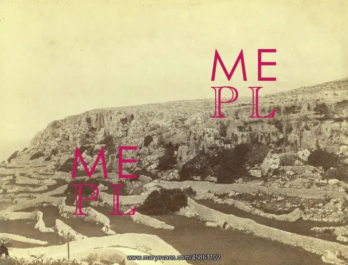
Mellieha Fault, Malta
The north eastern extremity of the Melleha Fault, by John Henry Cooke. Photo of the north eastern extremity of the Mellieha Fault, Malta. Mellieha is in the northwest of the island. The distinctive terraces fields of Malta can be seen in this image. Taken from the caverns in which Admiral Spratt found the Melleha hippopotamus Black and white albumen photograph
Picture No
14154359
Media ID
45861102
Size
2615px x 1995px
(1.0MB)
Credit
© The Geological Society / Mary Evans
Source
Geological Society of London. Archive reference: LDGSL/936/4 - Image reference: 05-32
Date
1893-1894
Pick your License
Caverns Cooke Distinctive Extremity Fault Geological Hippopotamus Northwest Spratt Terraces
Features In These Collections
> Contributors > GSO



















![Earliest geological map of Ireland [1814]](/sq/800/earliest-geological-map-ireland-1814-48658336.jpg.webp "Earliest geological map of Ireland [1814]")



![Draft of the first geological map of Jersey [c.1828]](/sq/800/draft-first-geological-map-jersey-c1828-48658294.jpg.webp "Draft of the first geological map of Jersey [c.1828]")
![First geological map of Jersey [c.1828]](/sq/800/first-geological-map-jersey-c1828-48658274.jpg.webp "First geological map of Jersey [c.1828]")

![First Geological Map of Scotland [1808]](/sq/800/first-geological-map-scotland-1808-48658245.jpg.webp "First Geological Map of Scotland [1808]")


