
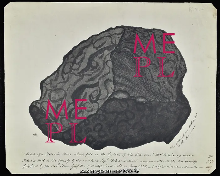
Meteorite that fell in County Limerick
Watercolour of a meteorite, by Etheldred Benett (1775-1845), that fell in County Limerick in September 1813. Benett's caption reads: aeSketch of a Meteoric Stone which fell on the estate of the late Reverend Mr Blakeney near Patricks Well in the County of Limerick in September 1813, and which was presented to the University of Oxford by the Reverend John Griffiths of Bishopstrow, Wiltshire in May 1825 - weight 19 pounds. The streaked and dotted part is the fracture.n Watercolour
Picture No
14154523
Media ID
45798297
Size
4748px x 3805px
(2.1MB)
Credit
© The Geological Society / Mary Evans
Source
Geological Society of London. Archive reference: LDGSL/544/3 - Image reference: 10-01
Date
1825



















![Earliest geological map of Ireland [1814]](/sq/800/earliest-geological-map-ireland-1814-48658336.jpg.webp "Earliest geological map of Ireland [1814]")



![Draft of the first geological map of Jersey [c.1828]](/sq/800/draft-first-geological-map-jersey-c1828-48658294.jpg.webp "Draft of the first geological map of Jersey [c.1828]")
![First geological map of Jersey [c.1828]](/sq/800/first-geological-map-jersey-c1828-48658274.jpg.webp "First geological map of Jersey [c.1828]")

![First Geological Map of Scotland [1808]](/sq/800/first-geological-map-scotland-1808-48658245.jpg.webp "First Geological Map of Scotland [1808]")


