
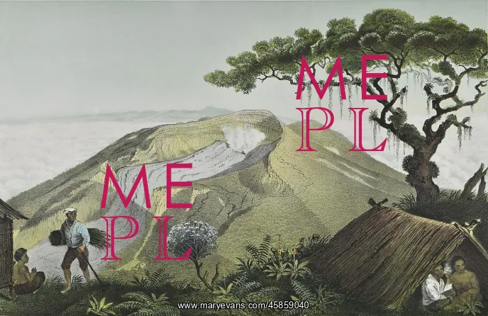
Mount Gede, Java
Gunung-GZIde ('Mount Gede'), by J Tempeltey. Lithograph of the summit of the volcano Mount Gede on the island of Java, Indonesia. Gede means big in Sundanese, a language spoken in the western part of Java. This volcano was very active in the 19th and first half of the 20th century. Lithograph
Picture No
14154151
Media ID
45859040
Size
5894px x 3823px
(3.9MB)
Credit
© The Geological Society / Mary Evans
Source
Geological Society of London. Junghuhn's Landschaften-Atlas zu Java', which accompanied his four volume Java: deszelfs gedaante, bekleeding en inwendige struktuur (Java: its shape, vegetation cover and inner construction)', (Amsterdam: PN Van Kampen, 1850-1854). - Image reference: 02-23a
Date
1850-1854



















![Earliest geological map of Ireland [1814]](/sq/800/earliest-geological-map-ireland-1814-48658336.jpg.webp "Earliest geological map of Ireland [1814]")



![Draft of the first geological map of Jersey [c.1828]](/sq/800/draft-first-geological-map-jersey-c1828-48658294.jpg.webp "Draft of the first geological map of Jersey [c.1828]")
![First geological map of Jersey [c.1828]](/sq/800/first-geological-map-jersey-c1828-48658274.jpg.webp "First geological map of Jersey [c.1828]")

![First Geological Map of Scotland [1808]](/sq/800/first-geological-map-scotland-1808-48658245.jpg.webp "First Geological Map of Scotland [1808]")


