
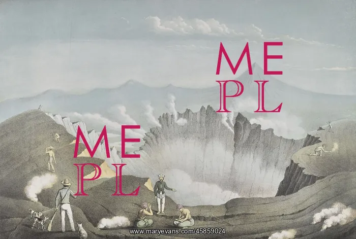
Mount Guntur, Java
Gunung Gunter ('Mount Guntur'), by Franz Wilhelm Junghuhn, Winckelmann and SOhne. Lithograph of the volcano Mount Guntur, on the island of Java, Indonesia, smoking. It erupted frequently in the 19th century. Its name, Guntur, means thunder in Indonesian. Lithograph
Picture No
14154150
Media ID
45859024
Size
5800px x 3907px
(3.0MB)
Credit
© The Geological Society / Mary Evans
Source
Geological Society of London. Junghuhn's Landschaften-Atlas zu Java', which accompanied his four volume Java: deszelfs gedaante, bekleeding en inwendige struktuur (Java: its shape, vegetation cover and inner construction)', (Amsterdam: PN Van Kampen, 1850-1854). - Image reference: 02-22a
Date
1850-1854
Pick your License
1850-1854 Disasters Erupted Eruptions Frequently Geological Gunter Gunung Indonesian Java Junghuhn Means Sohne Thunder Volcanic Volcano Volcanoes Winckelmann
Features In These Collections
> Contributors > GSO



















![Earliest geological map of Ireland [1814]](/sq/800/earliest-geological-map-ireland-1814-48658336.jpg.webp "Earliest geological map of Ireland [1814]")



![Draft of the first geological map of Jersey [c.1828]](/sq/800/draft-first-geological-map-jersey-c1828-48658294.jpg.webp "Draft of the first geological map of Jersey [c.1828]")
![First geological map of Jersey [c.1828]](/sq/800/first-geological-map-jersey-c1828-48658274.jpg.webp "First geological map of Jersey [c.1828]")

![First Geological Map of Scotland [1808]](/sq/800/first-geological-map-scotland-1808-48658245.jpg.webp "First Geological Map of Scotland [1808]")


