
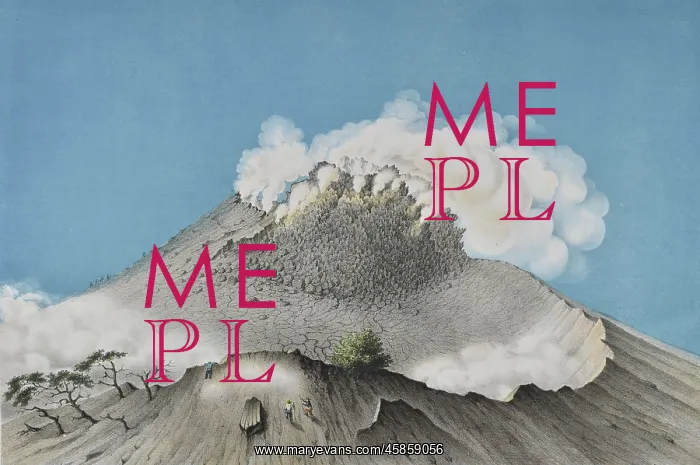
Mount Merapi, Java
Gunung-MZIrapi ('Mount Merapi'), by Franz Wilhelm Junghuhn, Winckelmann and SOhne. Lithograph of the smoking summit of the volcano Mount Merapi on the island of Java, Indonesia. It is one of the most active volcanoes in Indonesia and erupts frequently, most recently in 2013. This is particularly problematic as it is located in a densely populated area, north of the city of Yogyakarta, and as a result it is monitored extremely closely. Its name can be translated as fire mountain'. Lithograph
Picture No
14154152
Media ID
45859056
Size
5889px x 3912px
(3.6MB)
Credit
© The Geological Society / Mary Evans
Source
Geological Society of London. Junghuhn's Landschaften-Atlas zu Java', which accompanied his four volume Java: deszelfs gedaante, bekleeding en inwendige struktuur (Java: its shape, vegetation cover and inner construction)', (Amsterdam: PN Van Kampen, 1850-1854). - Image reference: 02-24a
Date
1850-1854
Pick your License
1850-1854 Closely Densely Disasters Eruptions Erupts Extremely Frequently Geological Java Junghuhn Monitored Particularly Populated Problematic Result Sohne Translated Volcanic Volcano Volcanoes Winckelmann Yogyakarta
Features In These Collections
> Contributors > GSO



















![Earliest geological map of Ireland [1814]](/sq/800/earliest-geological-map-ireland-1814-48658336.jpg.webp "Earliest geological map of Ireland [1814]")



![Draft of the first geological map of Jersey [c.1828]](/sq/800/draft-first-geological-map-jersey-c1828-48658294.jpg.webp "Draft of the first geological map of Jersey [c.1828]")
![First geological map of Jersey [c.1828]](/sq/800/first-geological-map-jersey-c1828-48658274.jpg.webp "First geological map of Jersey [c.1828]")

![First Geological Map of Scotland [1808]](/sq/800/first-geological-map-scotland-1808-48658245.jpg.webp "First Geological Map of Scotland [1808]")


