
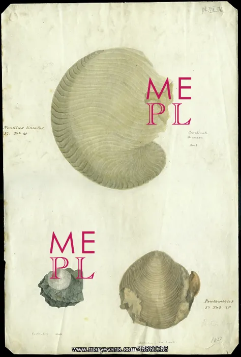
Nautilus and bivalves
Nautilus lineatus, Cornbrash, Bromham, rock and two other bivalves, by Richard Cowling Taylor (1789-1851). The drawings have been annotated by George Bellas Greenough, probably cross referencing the fossils with those which appear in James Sowerby's publication Mineral Conchology (1812-1829). Watercolour on paper
Picture No
14154264
Media ID
45860256
Size
6130px x 9059px
(13.5MB)
Credit
© The Geological Society / Mary Evans
Source
Geological Society of London. Archive reference: LDGSL/573-7 - Image reference: 04-45
Date
circa 1810s-1820s
Pick your License
Annotated Appear Bellas Bivalves Bromham Conchology Cowling Fossils Fossilss Geological Greenough Lineatus Mineral Nautilus Palaeontology Referencing Sowerbys
Features In These Collections
> Contributors > GSO



















![Earliest geological map of Ireland [1814]](/sq/800/earliest-geological-map-ireland-1814-48658336.jpg.webp "Earliest geological map of Ireland [1814]")



![Draft of the first geological map of Jersey [c.1828]](/sq/800/draft-first-geological-map-jersey-c1828-48658294.jpg.webp "Draft of the first geological map of Jersey [c.1828]")
![First geological map of Jersey [c.1828]](/sq/800/first-geological-map-jersey-c1828-48658274.jpg.webp "First geological map of Jersey [c.1828]")

![First Geological Map of Scotland [1808]](/sq/800/first-geological-map-scotland-1808-48658245.jpg.webp "First Geological Map of Scotland [1808]")


