
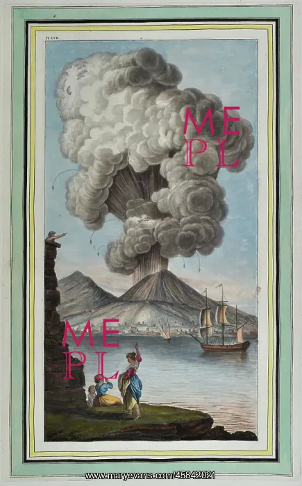
Plate LVII: View of the eruption of Mount Vesuvius
Plate LVII: View of the eruption of mount Vesuvius, Monday morning August the 9th 1779, and of the magnificent column of smoke which attended that eruption, taken from an original drawing done from nature at Pausilipo by M. Peter Fabris. by Pietro Fabris (fl 1740-1792). The source of this plate, Campi Phlegraei, is a first hand account of the eruptions witnessed by Sir William Hamilton (1730-1803), British envoy to Naples between 1764-1767. Originally published in three volumes (1776-1779), the title took its name from the area around Naples popularly referred to as Campi Phlegraei or flaming fields, owing to the frequent and violent eruptions of Mount Vesuvius. Hand coloured etching
Pick your License
1730-1803 1740-1792 1764-1767 1776-1779 1779 1799 Account Campi Done Dynamic Envoy Eruption Eruptions Fabris Flaming Frequent Geological Lava Magma Magnificent Monday Owing Phlegraei Popularly Referred Source Vesuvius Violent Volcanic Volcano Volcanology Volumes Vulcanology Witnessed
Features In These Collections
> Contributors > GSO



















![Earliest geological map of Ireland [1814]](/sq/800/earliest-geological-map-ireland-1814-48658336.jpg.webp "Earliest geological map of Ireland [1814]")



![Draft of the first geological map of Jersey [c.1828]](/sq/800/draft-first-geological-map-jersey-c1828-48658294.jpg.webp "Draft of the first geological map of Jersey [c.1828]")
![First geological map of Jersey [c.1828]](/sq/800/first-geological-map-jersey-c1828-48658274.jpg.webp "First geological map of Jersey [c.1828]")

![First Geological Map of Scotland [1808]](/sq/800/first-geological-map-scotland-1808-48658245.jpg.webp "First Geological Map of Scotland [1808]")


