
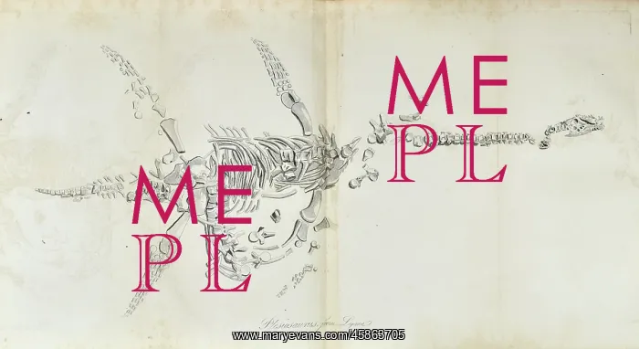
Plesiosaurus from Lyme Regis
The image is an inverted copy of the plate published in 1824 which described the first articulated plesiosaur which was discovered by Mary Anning (1799-1847) in December 1823. Lithograph
Picture No
14154641
Media ID
45863705
Size
5640px x 3078px
(1.6MB)
Credit
© The Geological Society / Mary Evans
Source
Geological Society of London. Pidgeon, E, The fossil remains of the animal kingdom', London: Whittaker, Treacher and Co (1830), after Conybeare, W D, aeOn the Discovery of an almost perfect Skeleton of the Plesiosaurusn, Transactions of the Geological Society of London, Series 2, vol 1 (1824), pp381-389 - Image reference: 27-09
Date
1830
Pick your License
1799-1847 1823 1824 Anning Articulated Described Discovered Inverted Lyme Plesiosaur Plesiosaurus Regis
Features In These Collections
> Contributors > GSO



















![Earliest geological map of Ireland [1814]](/sq/800/earliest-geological-map-ireland-1814-48658336.jpg.webp "Earliest geological map of Ireland [1814]")



![Draft of the first geological map of Jersey [c.1828]](/sq/800/draft-first-geological-map-jersey-c1828-48658294.jpg.webp "Draft of the first geological map of Jersey [c.1828]")
![First geological map of Jersey [c.1828]](/sq/800/first-geological-map-jersey-c1828-48658274.jpg.webp "First geological map of Jersey [c.1828]")

![First Geological Map of Scotland [1808]](/sq/800/first-geological-map-scotland-1808-48658245.jpg.webp "First Geological Map of Scotland [1808]")


