
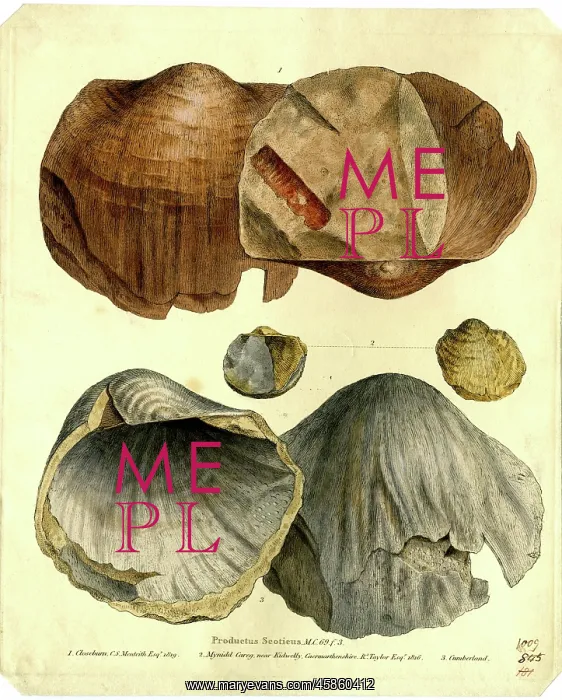
Productus scoticusÂ
Productus scoticus, by Creator: James Sowerby (1757-1822. Separately published print showing three specimens of Productus scoticus. The short captions indicate location, owners and date of discovery: 1. Closeburn, Cs Menteith Esquire, 1819; 2. Mynidd Careg, near Kidwelly, Caermarthenshire, Richard Taylor Esquire, 1816; 3. Cumberland. The print was on sale for 1s in 1819 but by 1822 the price had risen to 1s 6d. Coloured etching
Picture No
14154281
Media ID
45860412
Size
5643px x 7025px
(8.4MB)
Credit
© The Geological Society / Mary Evans
Source
Geological Society of London. Archive reference: LDGSL/593 - Image reference: 04-62
Date
1819
Pick your License
1757-1822 1816 1819 1822 Captions Creator Cumberland Esquire Fossils Geological Indicate Menteith Owners Palaeontology Risen Separately Sowerby Specimens
Features In These Collections
> Contributors > GSO



















![Earliest geological map of Ireland [1814]](/sq/800/earliest-geological-map-ireland-1814-48658336.jpg.webp "Earliest geological map of Ireland [1814]")



![Draft of the first geological map of Jersey [c.1828]](/sq/800/draft-first-geological-map-jersey-c1828-48658294.jpg.webp "Draft of the first geological map of Jersey [c.1828]")
![First geological map of Jersey [c.1828]](/sq/800/first-geological-map-jersey-c1828-48658274.jpg.webp "First geological map of Jersey [c.1828]")

![First Geological Map of Scotland [1808]](/sq/800/first-geological-map-scotland-1808-48658245.jpg.webp "First Geological Map of Scotland [1808]")


