
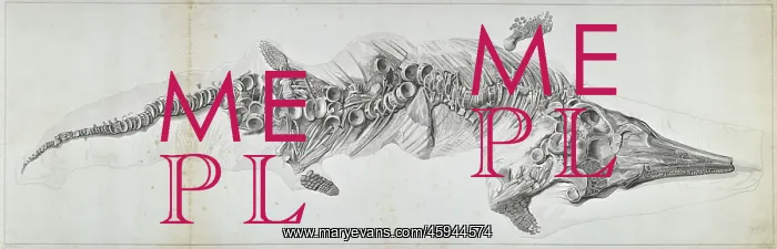
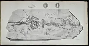
Proteosaurus, an ichthyosaur
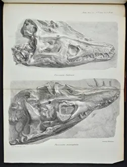
Engraving of Proteo-saurus, an ichthyosaur from Lyme Regis, by William Clift, James Basire. The fossil on which this image is based, was the most complete example of an ichthyosaur ever found at the time of its discovery by Mary Anning (1799-1847) in 1818. The specimen, which was owned by Lt-Col Thomas James Birch, was sold in aid of Anning and her family in 1820. It was purchased by the Royal College of Surgeons for the sum of £100, but was destroyed in an air raid in May 1941. Engraving
Picture No
14154208
Media ID
45944574
Size
12232px x 3926px
(6.7MB)
Credit
© The Geological Society / Mary Evans
Source
Geological Society of London. Archive reference: LDGSL/636 - Image reference: 03-08
Date
1819






















![Earliest geological map of Ireland [1814]](/sq/800/earliest-geological-map-ireland-1814-48658336.jpg.webp "Earliest geological map of Ireland [1814]")



![Draft of the first geological map of Jersey [c.1828]](/sq/800/draft-first-geological-map-jersey-c1828-48658294.jpg.webp "Draft of the first geological map of Jersey [c.1828]")
![First geological map of Jersey [c.1828]](/sq/800/first-geological-map-jersey-c1828-48658274.jpg.webp "First geological map of Jersey [c.1828]")

![First Geological Map of Scotland [1808]](/sq/800/first-geological-map-scotland-1808-48658245.jpg.webp "First Geological Map of Scotland [1808]")


