
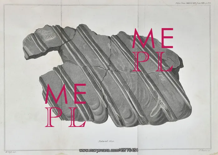
Ribs of an ichthyosaur
Ribs of an ichthyosaur (Temnodontosaurus platyodon), embedded in the Blue Lias showing their fluted appearance, engraved by James Basire after drawing by William Clift. The creature was found by the thirteen year old Mary Anning (1799-1847) in November 1812
Picture No
14154636
Media ID
45776454
Size
4229px x 2998px
(1.9MB)
Credit
© The Geological Society / Mary Evans
Source
Geological Society of London. Home, E, aeSome account of the fossil remains of an animal more nearly allied to fishes than any of the other classes of animalsn, Philosophical Transactions of the Royal Society', vol 104 (1814), pp571-577 - Image reference: 27-04
Date
1814



















![Earliest geological map of Ireland [1814]](/sq/800/earliest-geological-map-ireland-1814-48658336.jpg.webp "Earliest geological map of Ireland [1814]")



![Draft of the first geological map of Jersey [c.1828]](/sq/800/draft-first-geological-map-jersey-c1828-48658294.jpg.webp "Draft of the first geological map of Jersey [c.1828]")
![First geological map of Jersey [c.1828]](/sq/800/first-geological-map-jersey-c1828-48658274.jpg.webp "First geological map of Jersey [c.1828]")

![First Geological Map of Scotland [1808]](/sq/800/first-geological-map-scotland-1808-48658245.jpg.webp "First Geological Map of Scotland [1808]")


