
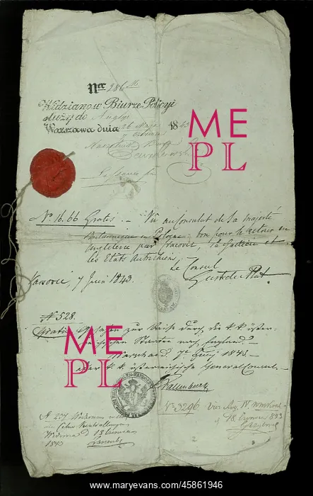
Roderick Murchison's Russian passport
Roderick Murchison's Russian passport, by Murchison, was elected to the Society on 3 December 1824, was a Scottish geologist who famously travelled in Russia between 1840 and 1845 to study its Palaeozoic rocks. His studies in Russia resulted in his defining a third geological system " the Permian, named after Perm " to add to the two he had already classified " the Silurian and the Devonian. The results of his fieldtrips were published as: Murchison, R I, The geology of Russia in Europe and the Ural Mountains, London: John Murray (1845). Printed paper
Picture No
14154493
Media ID
45861946
Size
2927px x 4625px
(2.1MB)
Credit
© The Geological Society / Mary Evans
Source
Geological Society of London. Archive reference: LDGSL/866 - Image reference: 09-32
Date
1843




















![Earliest geological map of Ireland [1814]](/sq/800/earliest-geological-map-ireland-1814-48658336.jpg.webp "Earliest geological map of Ireland [1814]")



![Draft of the first geological map of Jersey [c.1828]](/sq/800/draft-first-geological-map-jersey-c1828-48658294.jpg.webp "Draft of the first geological map of Jersey [c.1828]")
![First geological map of Jersey [c.1828]](/sq/800/first-geological-map-jersey-c1828-48658274.jpg.webp "First geological map of Jersey [c.1828]")

![First Geological Map of Scotland [1808]](/sq/800/first-geological-map-scotland-1808-48658245.jpg.webp "First Geological Map of Scotland [1808]")


