
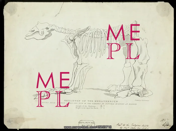
Skeleton of a Megatherium
Print of the Skeleton of the Megatherium found near Buenos Ayres and now in the cabinet of Natural History at Madrid.. lithographed by by George Scharf and printed by Charles Hullmandel, possibly after drawing by Henry Hall. A Megatherium was a ground sloth, the size of a modern elephant which lived during the Pliocene. Usually found in South America, this specimen was sent from Buenos Aires to Madrid in 1789 and named by Georges Cuvier in 1796
Picture No
14154216
Media ID
45859718
Size
8718px x 6483px
(7.1MB)
Credit
© The Geological Society / Mary Evans
Source
Geological Society of London. Archive reference: LDGSL/663 - Image reference: 03-18
Date
1824-1826
Pick your License
1789 1796 Aires Ayres Buenos Cuvier Geological Hullmandel Lithographed Lived Megatherium Pliocene Scharf Skeletons Sloth Usually
Features In These Collections
> Contributors > GSO



















![Earliest geological map of Ireland [1814]](/sq/800/earliest-geological-map-ireland-1814-48658336.jpg.webp "Earliest geological map of Ireland [1814]")



![Draft of the first geological map of Jersey [c.1828]](/sq/800/draft-first-geological-map-jersey-c1828-48658294.jpg.webp "Draft of the first geological map of Jersey [c.1828]")
![First geological map of Jersey [c.1828]](/sq/800/first-geological-map-jersey-c1828-48658274.jpg.webp "First geological map of Jersey [c.1828]")

![First Geological Map of Scotland [1808]](/sq/800/first-geological-map-scotland-1808-48658245.jpg.webp "First Geological Map of Scotland [1808]")


