
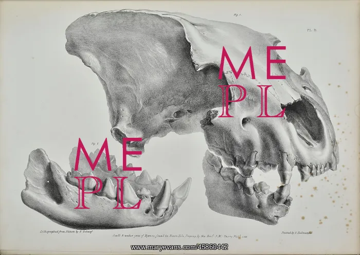
Skull of a hyaena from Kent's Cavern
Scull and under jaws of Hyaenas, found in Kent's Hole, Torquay, by the Rev J McEnery, by George Scharf (1788-1860). Kent's Cavern, in Torquay, had long attracted visitors as a natural curiosity but first came to scientific prominence in 1824 when a tourist Mr J Northmore was recommended to visit the site in his pursuit of possible Mithraic artefacts. There were no signs of druids but he did find mammalian remains. The Rev William Buckland (1784-1856) had been conducting excavations in other bone caves during this period and was therefore alerted. Not having the time to oversee the project himself, Buckland encouraged the Roman Catholic priest Father John MacEnery (1797-1841) to undertake the excavations. Between 1825-1829 McEnery found the bones of extinct animals such as bears, hyaenas, rhinoceros and deer. Most controversially MacEnery claimed to have found evidences of man-made flints in amongst the animal bones. Buckland, like many geologists in the early 19th century, held the widespread belief that humanity was of recent origin, specifically post-diluvian that is deriving from after Noah's Flood. Anything which diverged from this view was either dismissed or interpreted as being of later origin. Lithograph
Pick your License
1784-1856 1788-1860 1797-1841 1824 1825-1829 Alerted Amongst Anything Artefacts Attracted Bones Buckland Cavern Caves Claimed Conducting Controversially Curiosity Deriving Dismissed Druids Either Encouraged Evidences Excavations Flints Fossils Geological Geologists Humanity Hyaenas Interpreted Jaws Macenery Mammalian Man-made Mcenery Mithraic Northmore Origin Oversee Palaeontology Possible Prominence Pursuit Recent Recommended Rhinoceros Scharf Scull Specifically Therefore Torquay Undertake Widespread
Features In These Collections
> Contributors > GSO



















![Earliest geological map of Ireland [1814]](/sq/800/earliest-geological-map-ireland-1814-48658336.jpg.webp "Earliest geological map of Ireland [1814]")



![Draft of the first geological map of Jersey [c.1828]](/sq/800/draft-first-geological-map-jersey-c1828-48658294.jpg.webp "Draft of the first geological map of Jersey [c.1828]")
![First geological map of Jersey [c.1828]](/sq/800/first-geological-map-jersey-c1828-48658274.jpg.webp "First geological map of Jersey [c.1828]")

![First Geological Map of Scotland [1808]](/sq/800/first-geological-map-scotland-1808-48658245.jpg.webp "First Geological Map of Scotland [1808]")


