
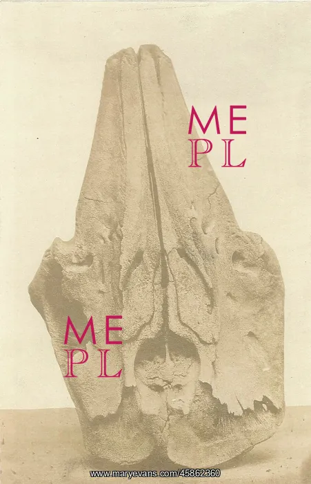
Skull of a whale from Spitzbergen
Albumen photograph of part of a skull of a whale, found by James Lamont in Spitzbergen, Norway during an expedition in the summer of 1859. Lamont reported, On all parts of Spitzbergen and its islands which I have visited, I have found numerous bones of Whales far inland and high above the sea-level..some of these were discovered and brought to me by the sailing-master of my yacht, so that I cannot personally vouch for the accuracy of the heights and distances marked on all of them but one large piece of a jawbone (sent in October 1859) was discovered by myself at 40 feet above the sea. It was part of an entire skeleton, which lay half-buried in moss at about half-a-mile distance from the sea in Walter Thymen's Straits, North-east Spitzbergen.n Photograph
Pick your License
Accuracy Bones Cannot Discovered Distances Entire Half-a-mile Heights Inland Jawbone Lamont Myself North-east Numerous Personally Reported Spitzbergen Straits Whale Whales
Features In These Collections
> Contributors > GSO



















![Earliest geological map of Ireland [1814]](/sq/800/earliest-geological-map-ireland-1814-48658336.jpg.webp "Earliest geological map of Ireland [1814]")



![Draft of the first geological map of Jersey [c.1828]](/sq/800/draft-first-geological-map-jersey-c1828-48658294.jpg.webp "Draft of the first geological map of Jersey [c.1828]")
![First geological map of Jersey [c.1828]](/sq/800/first-geological-map-jersey-c1828-48658274.jpg.webp "First geological map of Jersey [c.1828]")

![First Geological Map of Scotland [1808]](/sq/800/first-geological-map-scotland-1808-48658245.jpg.webp "First Geological Map of Scotland [1808]")


