
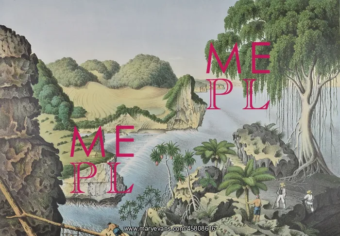
South coast of Java, Indonesia
Sudkuste ostwarts von Rongkop ('South coast east of Rongkop'), by Franz Wilhelm Junghuhn, Winckelmann and Sohne. Lithograph of the south coast of the island of Java, Indonesia, east of Rongkop. Rongkop is now a district in the regency of Gunung Kidal, which is in turn part of the province of Yogyakarta Special Region. Lithograph
Picture No
14154479
Media ID
45808616
Size
5739px x 3984px
(3.8MB)
Credit
© The Geological Society / Mary Evans
Source
Geological Society of London. From Junghuhn's Landschaften-Atlas zu Java', which accompanied his four volume Java: deszelfs gedaante, bekleeding en inwendige struktuur (Java: its shape, vegetation cover and inner construction)', (Amsterdam: PN Van Kampen, 1850-1854). - Image reference: 09-18a
Pick your License
Gunung Java Junghuhn Sohne Winckelmann Yogyakarta
Features In These Collections
> Contributors > GSO



















![Earliest geological map of Ireland [1814]](/sq/800/earliest-geological-map-ireland-1814-48658336.jpg.webp "Earliest geological map of Ireland [1814]")



![Draft of the first geological map of Jersey [c.1828]](/sq/800/draft-first-geological-map-jersey-c1828-48658294.jpg.webp "Draft of the first geological map of Jersey [c.1828]")
![First geological map of Jersey [c.1828]](/sq/800/first-geological-map-jersey-c1828-48658274.jpg.webp "First geological map of Jersey [c.1828]")

![First Geological Map of Scotland [1808]](/sq/800/first-geological-map-scotland-1808-48658245.jpg.webp "First Geological Map of Scotland [1808]")


