
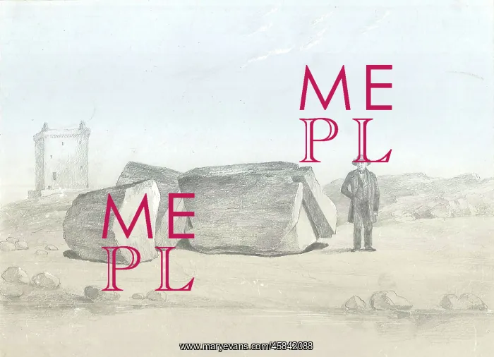
Split boulder on Little Cumbra, Western Isles
Split boulder on Little Cumbra (Little Cumbrae), Western Isles, Scotland, by James Smith of Jordanhill (1782-1867). Drawing of a split boulder found on Little Cumbrae, an island in the Firth of Clyde, Ayrshire, Scotland. James Smith, in his paper to the Geological Society, thought that it provided evidence of the existence of glaciers in the Clyde Valley. Stating in his paper, The block is composed of trap, apparently the same as that of the island, but at such a distance from any neighbouring height as to preclude the supposition that it could have fallen from it. I see therefore no other hypothesis by which we can account for its present position than that of supposing that it must have fallen from an escarpment of ice. Smith, J. On a Split Boulder in Little Cumbra, Western Isles, Quarterly Journal of the Geological Society, vol 18 (1862), pp162-164. Watercolour wash, pencil
Pick your License
Account Apparently Ayrshire Boulder Clyde Composed Cumbrae Escarpment Evidence Geological Glaciers Hypothesis Isles Journal Neighbouring Provided Quarterly Split Stating Supposing Therefore Trap Wash
Features In These Collections
> Contributors > GSO



















![Earliest geological map of Ireland [1814]](/sq/800/earliest-geological-map-ireland-1814-48658336.jpg.webp "Earliest geological map of Ireland [1814]")



![Draft of the first geological map of Jersey [c.1828]](/sq/800/draft-first-geological-map-jersey-c1828-48658294.jpg.webp "Draft of the first geological map of Jersey [c.1828]")
![First geological map of Jersey [c.1828]](/sq/800/first-geological-map-jersey-c1828-48658274.jpg.webp "First geological map of Jersey [c.1828]")

![First Geological Map of Scotland [1808]](/sq/800/first-geological-map-scotland-1808-48658245.jpg.webp "First Geological Map of Scotland [1808]")


