
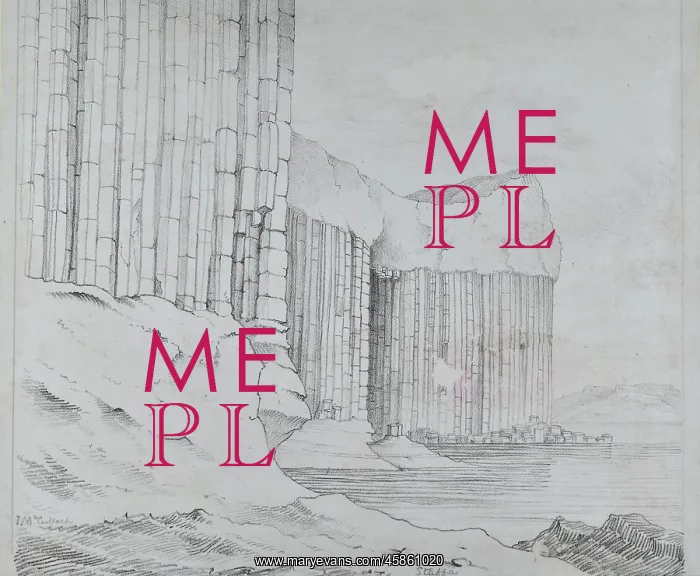
Staffa, showing Fingal's Cave
Sketch of the island of Staffa, in the Hebrides, with Fingal's Cave visible, by John MacCulloch. It is a sea cave, but it is possible to reach it overland from another part of the uninhabited island. The whole island is formed of columnar basalt and is a popular visitor attraction. Sketch
Picture No
14154351
Media ID
45861020
Size
4506px x 3711px
(2.0MB)
Credit
© The Geological Society / Mary Evans
Source
Geological Society of London. Archive reference: LDGSL/78/2/8 - Image reference: 05-22
Date
circa 1810s
Pick your License
1810s Basalt Columnar Formed Geological Hebrides Macculloch Overland Possible Reach Staffa Uninhabited Visible
Features In These Collections
> Contributors > GSO



















![Earliest geological map of Ireland [1814]](/sq/800/earliest-geological-map-ireland-1814-48658336.jpg.webp "Earliest geological map of Ireland [1814]")



![Draft of the first geological map of Jersey [c.1828]](/sq/800/draft-first-geological-map-jersey-c1828-48658294.jpg.webp "Draft of the first geological map of Jersey [c.1828]")
![First geological map of Jersey [c.1828]](/sq/800/first-geological-map-jersey-c1828-48658274.jpg.webp "First geological map of Jersey [c.1828]")

![First Geological Map of Scotland [1808]](/sq/800/first-geological-map-scotland-1808-48658245.jpg.webp "First Geological Map of Scotland [1808]")


