
Temple of Serapis
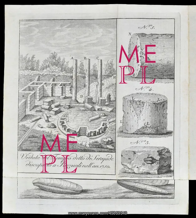
Veduta del Tempio detto di Serapide discoperto a Pozzuoli nell'anno 1750 (View of the said Temple of Serapide discovered at Pozzuoli in the year 1750), by unknown artist. The Temple of Serapis is probably one of the most important geological sites in the world. Found in Pozzuoli, near Naples, Italy, it was initially discovered in 1749 when three of the columns were spotted sticking out from the ground. It was first excavated in 1750 which revealed that part way up the columns were signs of borings from marine bivalves. This indicated that the temple was built above sea level, then been under water but was elevated again " the latter caused by the volcanic eruption of Monte Nuovo in 1538. Engraving
Picture No
14154200
Media ID
45859540
Size
3356px x 3730px
(2.0MB)
Credit
© The Geological Society / Mary Evans
Source
Geological Society of London. From Ermenegildo Pini, Viaggio geologico per diverse parti meridionali dell' Italia. Esposto in lettere'. 2a edn. Milano: Nella Stamperia Mainardi (1802). - Image reference: 02-72
Date
1802



















![Earliest geological map of Ireland [1814]](/sq/800/earliest-geological-map-ireland-1814-48658336.jpg.webp "Earliest geological map of Ireland [1814]")



![Draft of the first geological map of Jersey [c.1828]](/sq/800/draft-first-geological-map-jersey-c1828-48658294.jpg.webp "Draft of the first geological map of Jersey [c.1828]")
![First geological map of Jersey [c.1828]](/sq/800/first-geological-map-jersey-c1828-48658274.jpg.webp "First geological map of Jersey [c.1828]")

![First Geological Map of Scotland [1808]](/sq/800/first-geological-map-scotland-1808-48658245.jpg.webp "First Geological Map of Scotland [1808]")


