
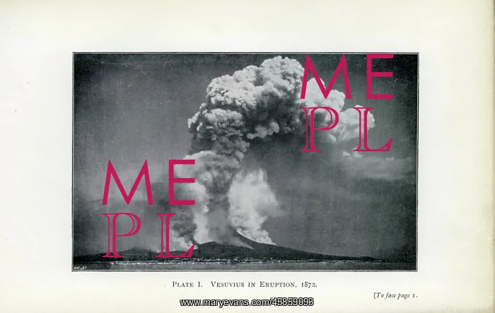
Vesuvius in Eruption, 1872
Vesuvius in Eruption, 1872, by unknown artist. The top of the crater is concealed, but the position can be approximately ascertained. The column of steam is at least three times the height of the mountain (about 4250 feet), or nearly 2 and a quarter miles vertical. The lava flowing down the slopes is also emitting steam. The photograph was the first ever taken of a volcano in eruption. Photographic illustration
Picture No
14154155
Media ID
45859093
Size
4782px x 3030px
(1.0MB)
Credit
© The Geological Society / Mary Evans
Source
Geological Society of London. Bonney, Thomas George, Volcanoes. Their structure and significance', London: John Murray (1912), Plate 1. - Image reference: 02-27
Date
1912
Pick your License
Approximately Ascertained Concealed Crater Dynamic Emitting Eruption Flowing Geological Lava Least Magma Nearly Slopes Vesuvius Volcanic Volcano Volcanology Vulcanology
Features In These Collections
> Contributors > GSO



















![Earliest geological map of Ireland [1814]](/sq/800/earliest-geological-map-ireland-1814-48658336.jpg.webp "Earliest geological map of Ireland [1814]")



![Draft of the first geological map of Jersey [c.1828]](/sq/800/draft-first-geological-map-jersey-c1828-48658294.jpg.webp "Draft of the first geological map of Jersey [c.1828]")
![First geological map of Jersey [c.1828]](/sq/800/first-geological-map-jersey-c1828-48658274.jpg.webp "First geological map of Jersey [c.1828]")

![First Geological Map of Scotland [1808]](/sq/800/first-geological-map-scotland-1808-48658245.jpg.webp "First Geological Map of Scotland [1808]")


