
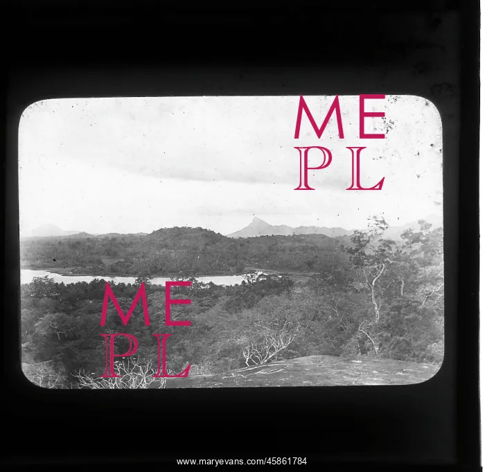
View from a Kurunegala rock, Sri Lanka
View from Kurunegala rock, Ceylon, by Ananda Kentish Coomaraswamy. Photo of the landscape, including the ancient man-made lake, seen from one of the rocks at Kurunegala, Sri Lanka. Today Kurunegala is a major city, being the capital of the North Western Province and at the junction of a number of main roads, while in the 13th and 14th centuries it was briefly a royal capital. The city is surrounded by eight large rocky outcrops, six of which are named after the animals they are said to resemble (elephant, tortoise, eel, goat, beetle, monkey). It is likely that this image was taken from the summit of one of these rocks, probably the largest - ethagala (elephant) rock. Black and white photographic lantern slide
Picture No
14154467
Media ID
45861784
Size
1902px x 1852px
(288KB)
Credit
© The Geological Society / Mary Evans
Source
Geological Society of London. Archive reference: LDGSL/1088/AC/CEY/1/4 - Image reference: 09-06
Date
1890s-1900s



















![Earliest geological map of Ireland [1814]](/sq/800/earliest-geological-map-ireland-1814-48658336.jpg.webp "Earliest geological map of Ireland [1814]")



![Draft of the first geological map of Jersey [c.1828]](/sq/800/draft-first-geological-map-jersey-c1828-48658294.jpg.webp "Draft of the first geological map of Jersey [c.1828]")
![First geological map of Jersey [c.1828]](/sq/800/first-geological-map-jersey-c1828-48658274.jpg.webp "First geological map of Jersey [c.1828]")

![First Geological Map of Scotland [1808]](/sq/800/first-geological-map-scotland-1808-48658245.jpg.webp "First Geological Map of Scotland [1808]")


