
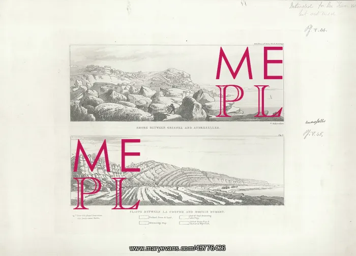
Views of the French coast
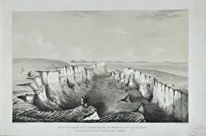
Two views of the French coast, by Unknown. Print of two views of the French coast between Grisnez and Audreselles and between La Creche and Moulin Hubert, showing Portland beds. The print was probably intended to illustrate the William Henry Fitton's paper, Observations on some of the Strata between the Chalk and the Oxford Oolite, in the South-east of England, Transactions of the Geological Society of London, Series 2, Vol 4 (1836), pp103-388, but was never published. Engraving with aquatint
Picture No
14154364
Media ID
45776436
Size
4689px x 3375px
(2.4MB)
Credit
© The Geological Society / Mary Evans
Source
Geological Society of London. Archive reference: LDGSL/518 - Image reference: 05-37
Date
1836
Pick your License
1836 Aquatint Beds Chalk Creche Geological Hubert Illustrate Intended Moulin Observations Oolite Portland South-east Strata Transactions
Features In These Collections
> Contributors > GSO
























![Earliest geological map of Ireland [1814]](/sq/800/earliest-geological-map-ireland-1814-48658336.jpg.webp "Earliest geological map of Ireland [1814]")



![Draft of the first geological map of Jersey [c.1828]](/sq/800/draft-first-geological-map-jersey-c1828-48658294.jpg.webp "Draft of the first geological map of Jersey [c.1828]")
![First geological map of Jersey [c.1828]](/sq/800/first-geological-map-jersey-c1828-48658274.jpg.webp "First geological map of Jersey [c.1828]")

![First Geological Map of Scotland [1808]](/sq/800/first-geological-map-scotland-1808-48658245.jpg.webp "First Geological Map of Scotland [1808]")


